












































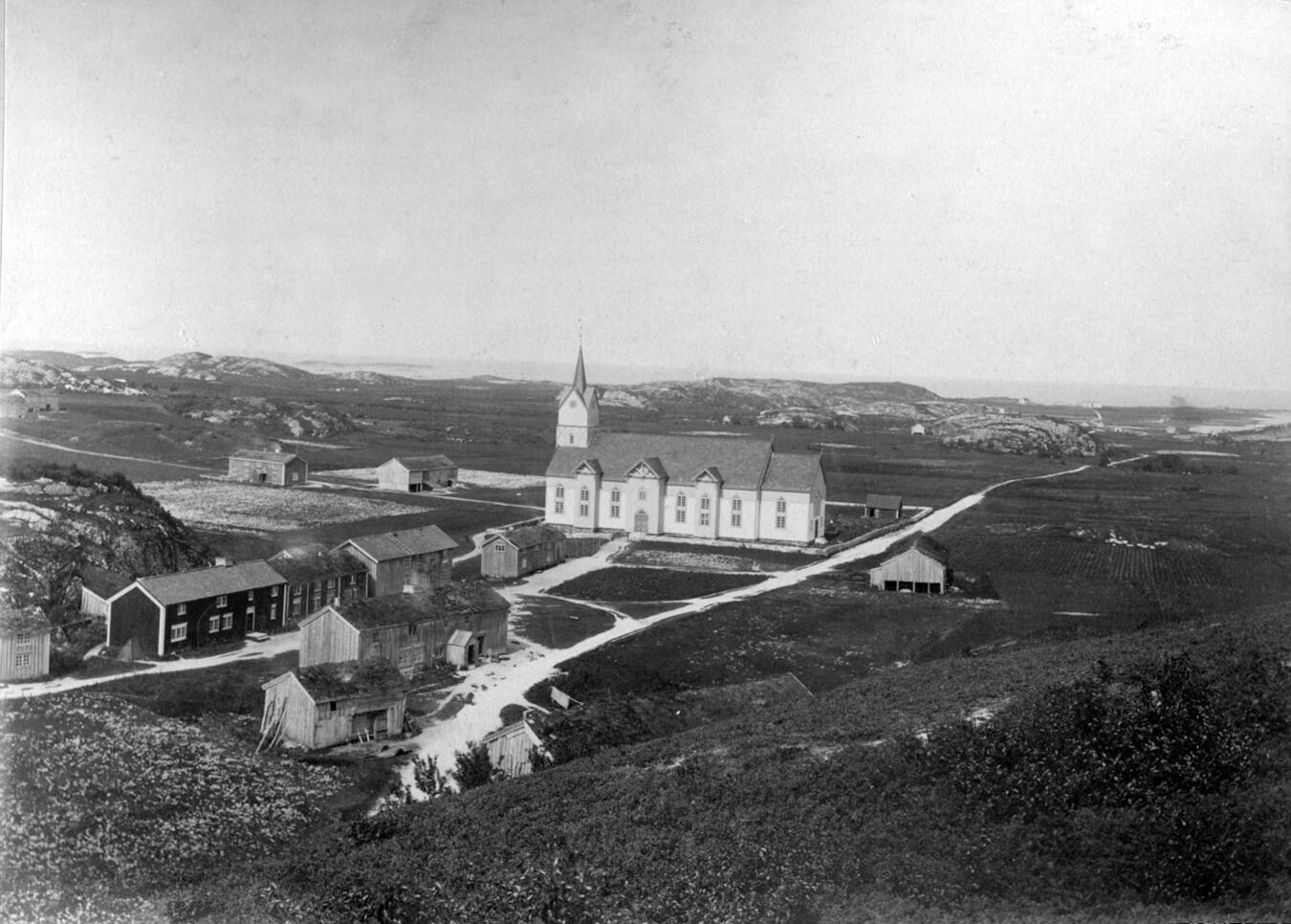

It is difficult to say exactly when the place was formed. It is equally difficult to say anything concrete about who built it. Even when Ermegard Benkestok, was born in 1610, Meløygården was an old and venerable estate.
There is no doubt that people have lived on Meløya for a long time. The first Noble name that can be linked to the area is “Gran”. This was as early as the 15th century. Sometime in the 16th century, Trond Tordsen Benkestok moved north and became the owner of Meløy estate.
Under their leadership, there were good times at Meløy. Their prosperity created security for those who lived in the village. But nothing lasts forever. In 1687, the estate was hit by a major fire, and most of the old buildings were consumed by the flames.
After the fire, new bouilding were built, but where the old once stood and what they looked like is lost. It is said that so much was built, that there were at most 13 farmhouses here. Until the middle of the 19th century, it was common for people to live in a close cluster surrounded by land that they worked together. In 1865, this arrangement was discontinued. The land areas were mapped, marked and divided into 13. With this, the estate's heyday was a thing of the past, but the place was still important.
As part of Rødø municipality, Meløya had long been the place where the local population received information about various sorts. So when Rødø was divided into 2 municipalities at the end of the 19th century, it was no surprise that Meløya became the center of the new municipality which was named after the island. The municipality had already bought the estate in 1872. The 7 buildings located on the common yard today are Almuestua, Kjeipen, Tortrupgården, Nerstua, Anders Larsa-huset, Dybvikhuset and Banken. After the purchase, these were used for various municipal purposes.
After a while in the 20th century, the buildings began to show their age. A number of restoration works were carried out, but it gradually became clear that the old buildings did not meet the new needs of a modern society. Questions were also raised about whether Meløya should continue as a municipal centre. Society had changed and what used to be the natural center had now become remote.
During the 19th century, the many trading posts in Meløy had gradually become the local centre. The Great Herring era increased wealth and their influence. Although these trading posts lost much of their power over the course of the 20th century, they still had great influence. The trading posts on Grønøy and Ørnes had long worked to get as many of the municipal functions as possible into their immediate proximity. So when it was to be decided where the main center would be place they of course join the discussions. In 1952, the choice fell on Ørnes. Incidentally, I can add that the person who once sold the estate to the municipality was Anders Dass Klæboe, of Ørnes trading post. This says something about the position the traders had at this time.
After this, Meløygården went into hibernation. The only building with significant activity was the bank. It was merged with Bodø sparebank in 1981, before the business on Meløya was closed in 1997.
Today, the Meløy estate has been handed over to the " Stiftelsen for vern av Meløygården". Some of the buildings are privately owned but are included as part of the communal yard. Like a shadow of its former grandeur, it lies there, quiet and peaceful.
But, if you close your eyes and listen, focus on the wind and the birdsong. Maybe you see it before you. Busy servants runing across the courtyard, creaking from a badly greased carriage wheel, handsome nobles in their finery, small squabbles on the church hill and mighty sounds from the bell tower.
Subject text: Helge Seim
Screenplay: Helge Seim og Jan Ivar Bårtvedt
Voices: Bente Sørgård
Editing: Helge seim
Music and Soundeffect: freesound.org
Source:
- Moe K. (1981) Gård og Grend I Meløy Meløy Kommune
- Myrvang A. (2001) Fra maktens sentrum til kulturhistorie
- Swensen P., Torsvik U. og Schulz H. (1984) Jubileumskrift meløy kommune 1984 Nordland Boktrykkeri