







Coordinates are latitude, longitude in decimal degrees (WGS 84).

  1. 66.84203871663892, 13.466422796249379
  2. 66.82196855625862, 13.342540667064714
  3. 66.834618597626, 13.400138871943161
  4. 66.82292909488751, 13.408750759164384
  5. 66.84212417868741, 13.466849178023427
  6. 66.82336085186984, 13.409240366188588
  7. 66.81885957710519, 13.41523377719108
  8. 66.84543193978449, 13.43374064715268
  9. 66.82197556271967, 13.41426900536669
  10. 66.83213120269993, 13.402805924415793
  11. 66.8237327720224, 13.348837703514791
  12. 66.81686372598224, 13.408739449655256
  13. 66.82035450965996, 13.337205561673207
  14. 66.82334852577858, 13.399817949091947
  15. 66.86842887616216, 13.705041552436548
  16. 66.86829323801891, 13.704666254012968
  17. 66.87186309896069, 13.707670508178849
  18. 66.79554081603636, 13.441868220849939
  19. 66.69517715616958, 13.766727447509767
  20. 66.69835888994209, 13.650712991391982
  21. 66.69722555196292, 13.691402503647936
  22. 66.92060958000577, 13.622497606661387
  23. 66.92195163091468, 13.623225536839922
  24. 66.69928483074024, 13.71148467063904
  25. 66.70306499675577, 13.733612895011904
  26. 66.69416749104799, 13.829732537269594
  27. 66.7100016791059, 13.709027767181398
  28. 66.70727897879685, 13.721001148223879
  29. 66.70505322785425, 13.727545738220217
  30. 66.70071145783837, 13.757500648498537
  31. 66.940404, 13.572814
  32. 66.9355638762474, 13.540446958370929
  33. 66.9203206108779, 13.622241438128002
  34. 66.80245486003179, 13.188067656104945
  35. 66.80104542157818, 13.224647055206477
  36. 66.80386095457119, 13.21351016966922
  37. 66.7892180091329, 13.124924504383895
  38. 66.79970207553208, 13.22310697599356
  39. 66.79743548653676, 13.215399720417128
  40. 66.934346, 13.522963
  41. 66.82255511468135, 13.407071051434277
  42. 66.82439472581102, 13.406276136936931
  43. 66.82347156809355, 13.406767081261046
  44. 66.933168, 13.518097
  45. 66.81562032501284, 13.937263516271141
  46. 66.81240025010652, 13.965651129342485
  47. 66.90956907870488, 13.63377571105957
  48. 66.81718526943135, 13.941054431292477
  49. 66.81145519092958, 13.980749649519199
  50. 66.81394025437443, 13.966155938595882
  51. 66.81086233910341, 13.88632297735874
  52. 66.81106413260048, 13.883712963299422
  53. 66.82267133224768, 13.40682216833223
  54. 66.77774619217725, 13.450493854444563
  55. 66.79419376100297, 14.008305851734422
  56. 66.79702658936306, 14.000280846371828
  57. 66.79693373484452, 14.00096068670254
  58. 66.82333585821746, 13.399893283843983
  59. 66.8186856873437, 13.414783217978341
  60. 66.82897351447136, 13.415153858647377
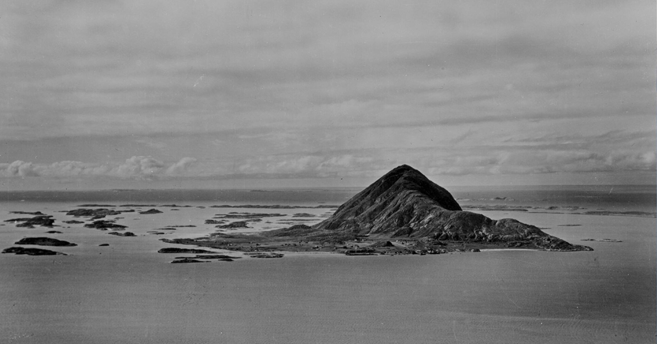
  • © Vilhelm Skappel, Widerøes Flyveselskap

Toponyms on Bolga

The name Bolga undoubtedly has its origins in the description of the shapes of the mountain that rises up from the sea,and comes from the Norse word bolg or bellows. Such a descriptive name is very old. Bolga is among the oldest types of Toponyms preserved in Norway. The name was probably sat on the island for more than 2,000 years ago, even before people settled here. The mountain has been a landmark to orient yourself traveling the coastline. The first time the name Bolga is written is in Aslak Bolt's land map from 1432. There are many other Toponyms here that are almost as old. Let me tell you about some of them.

One of the oldest is Alberget, or Alveberget as we originally said. The Name is over 1,000 years old and come from older Norse mythology. The elves are beings that dwell underground. Even after Christianity was introduced in Norway, people kept faith in them. Thus, right up to the previous generation, there was great faith in, and not least respect for, those who lived in the pile.
 
 
Another place name associated with Norrøne is Vethågen. The name is derived from the word vete. Here was one of the two old cairns in Meløy. It was Håkon the Good who around the year 950 established a warning system to summon the war fleet. The warning consisted of lighting fires at certain places along the coast, so that the light from the fire was visible from one place to another. It was said that it took 7 nights to warn the country from south to north. The last time we know that the cairn at Bolga was manned was in connection with the Great Nordic War in 1719. The important task assigned to Bolga went into oblivion after this, but the name of the mound lives on.
 
 
We also have Valbergshågen. It is probably derived from the Norse word valr, meaning falcon. A falcon had probably had a nest here. Falcons and hawks were very valuable for training for hunting.
 
Just behind, and above the old “fellestunet”, is Stuhågen. And since all the houses on Bolga once stood on “fellestunet, the name is very descriptive. That is, the hill by the houses
 
 
Finally, we have Kjellerhågen. The name comes from when it was common to have underground cellars. Here they dug the cellars down to approx. 3 meters in hard sand, and put a roof on. When the cellars started collapsing, they just dug a new one. It was only when the potato entered the household in the 18th century that frost-free storage like this was needed. The last cellar was in use in the 1930s.

Subject text: Per Swensen, Anne Marie Johnsen, Tone Lise Lyngeng

Screenplay: Helge Seim

Voices: Tone Lise Lyngeng

Editing: Helge Seim

Soundrecordings: LydBerger Sunflower Studios.


Music and Soundeffect: freesound.org


Source: 

  • Holberg E. (2015) Før vår tid
  • Hutchinson A. (1997) Disse tider-Disse skikker
  • Moe K. (1981) Gård og grend i Meløy, bind 1
  • Utskiftning for Bolga 1831
  • Utskiftning for Bolga 1867
  • Tolkning av navn, i samarbeide med Finn Myrvang, leder av Stednamnprosjekter i Nordland før 2004.