



























Coordinates are latitude, longitude in decimal degrees (WGS 84).

  1. 66.84203871663892, 13.466422796249379
  2. 66.82196855625862, 13.342540667064714
  3. 66.834618597626, 13.400138871943161
  4. 66.82292909488751, 13.408750759164384
  5. 66.84212417868741, 13.466849178023427
  6. 66.82336085186984, 13.409240366188588
  7. 66.81885957710519, 13.41523377719108
  8. 66.84543193978449, 13.43374064715268
  9. 66.82197556271967, 13.41426900536669
  10. 66.83213120269993, 13.402805924415793
  11. 66.8237327720224, 13.348837703514791
  12. 66.81686372598224, 13.408739449655256
  13. 66.82035450965996, 13.337205561673207
  14. 66.82334852577858, 13.399817949091947
  15. 66.86842887616216, 13.705041552436548
  16. 66.86829323801891, 13.704666254012968
  17. 66.87186309896069, 13.707670508178849
  18. 66.79554081603636, 13.441868220849939
  19. 66.69517715616958, 13.766727447509767
  20. 66.69835888994209, 13.650712991391982
  21. 66.69722555196292, 13.691402503647936
  22. 66.92060958000577, 13.622497606661387
  23. 66.92195163091468, 13.623225536839922
  24. 66.69928483074024, 13.71148467063904
  25. 66.70306499675577, 13.733612895011904
  26. 66.69416749104799, 13.829732537269594
  27. 66.7100016791059, 13.709027767181398
  28. 66.70727897879685, 13.721001148223879
  29. 66.70505322785425, 13.727545738220217
  30. 66.70071145783837, 13.757500648498537
  31. 66.940404, 13.572814
  32. 66.9355638762474, 13.540446958370929
  33. 66.9203206108779, 13.622241438128002
  34. 66.80245486003179, 13.188067656104945
  35. 66.80104542157818, 13.224647055206477
  36. 66.80386095457119, 13.21351016966922
  37. 66.7892180091329, 13.124924504383895
  38. 66.79970207553208, 13.22310697599356
  39. 66.79743548653676, 13.215399720417128
  40. 66.934346, 13.522963
  41. 66.82255511468135, 13.407071051434277
  42. 66.82439472581102, 13.406276136936931
  43. 66.82347156809355, 13.406767081261046
  44. 66.933168, 13.518097
  45. 66.81562032501284, 13.937263516271141
  46. 66.81240025010652, 13.965651129342485
  47. 66.90956907870488, 13.63377571105957
  48. 66.81718526943135, 13.941054431292477
  49. 66.81145519092958, 13.980749649519199
  50. 66.81394025437443, 13.966155938595882
  51. 66.81086233910341, 13.88632297735874
  52. 66.81106413260048, 13.883712963299422
  53. 66.82267133224768, 13.40682216833223
  54. 66.77774619217725, 13.450493854444563
  55. 66.79419376100297, 14.008305851734422
  56. 66.79702658936306, 14.000280846371828
  57. 66.79693373484452, 14.00096068670254
  58. 66.82333585821746, 13.399893283843983
  59. 66.8186856873437, 13.414783217978341
  60. 66.82897351447136, 13.415153858647377
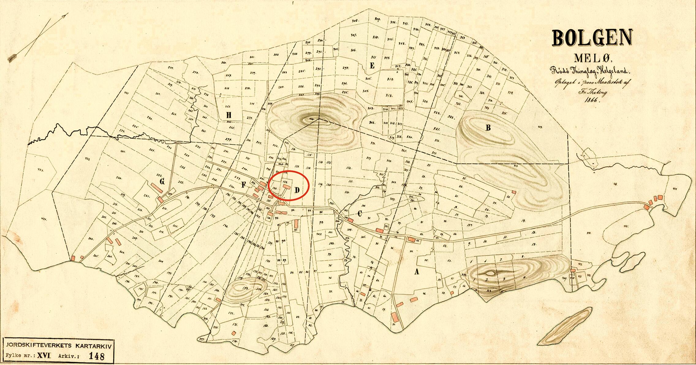
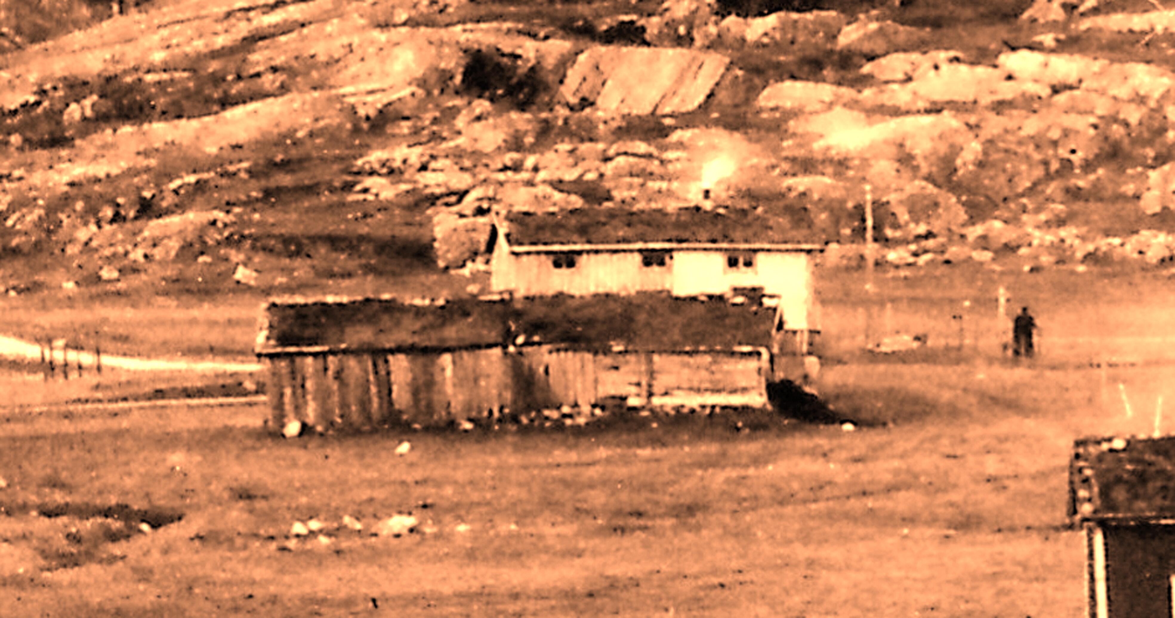
  • Felelstunet

    © Fr. Theling 1866

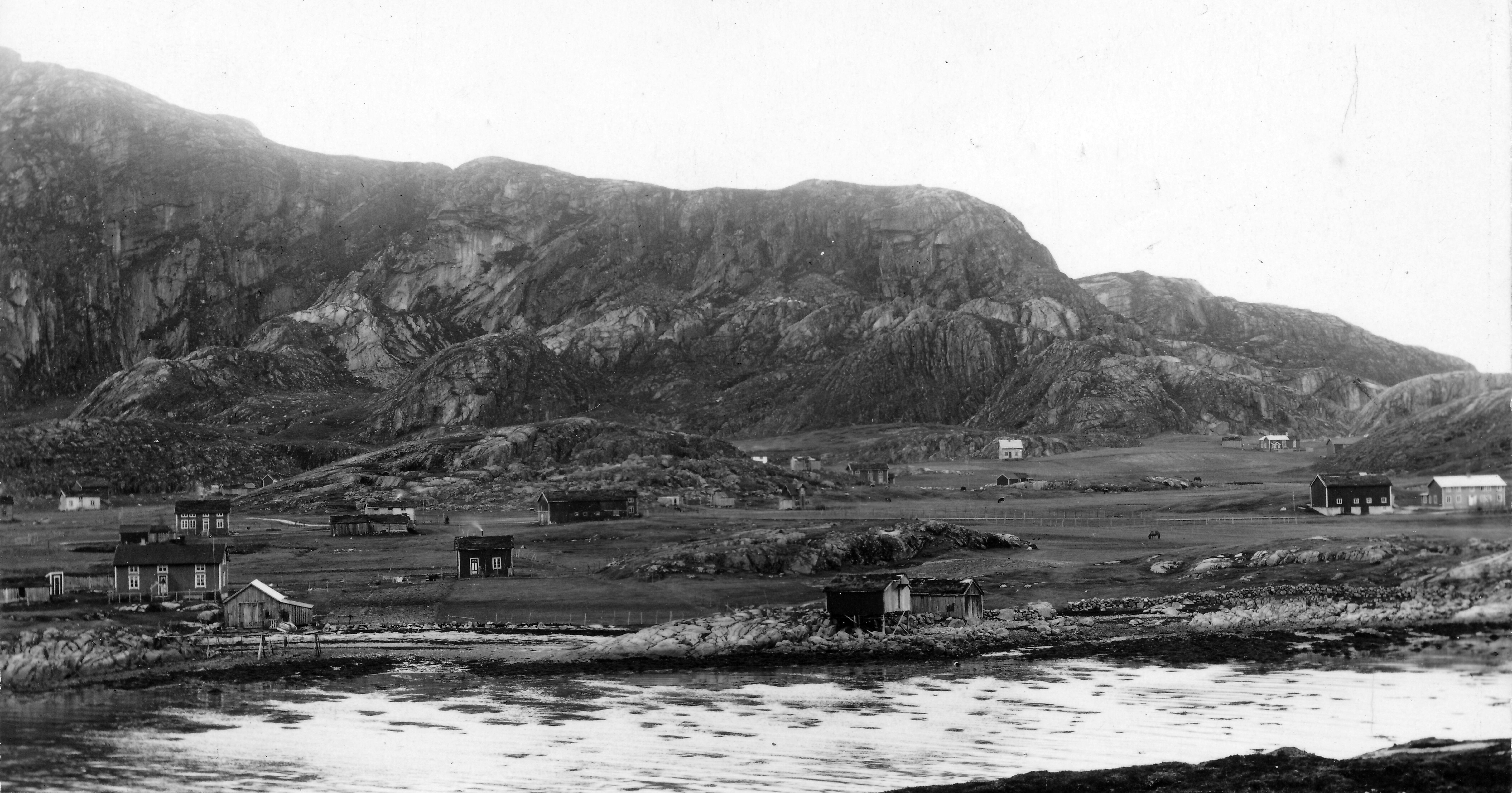
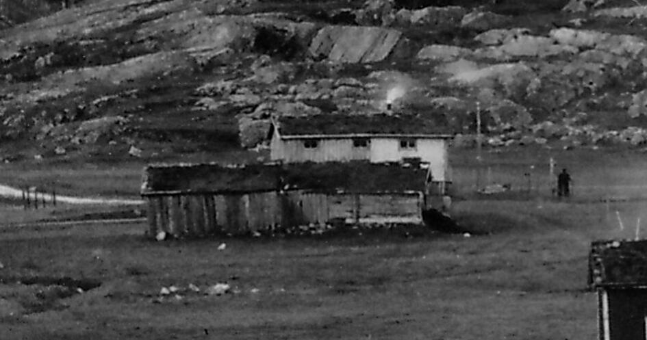
  • Fellestunet 1938-40

    © H. Benonisen

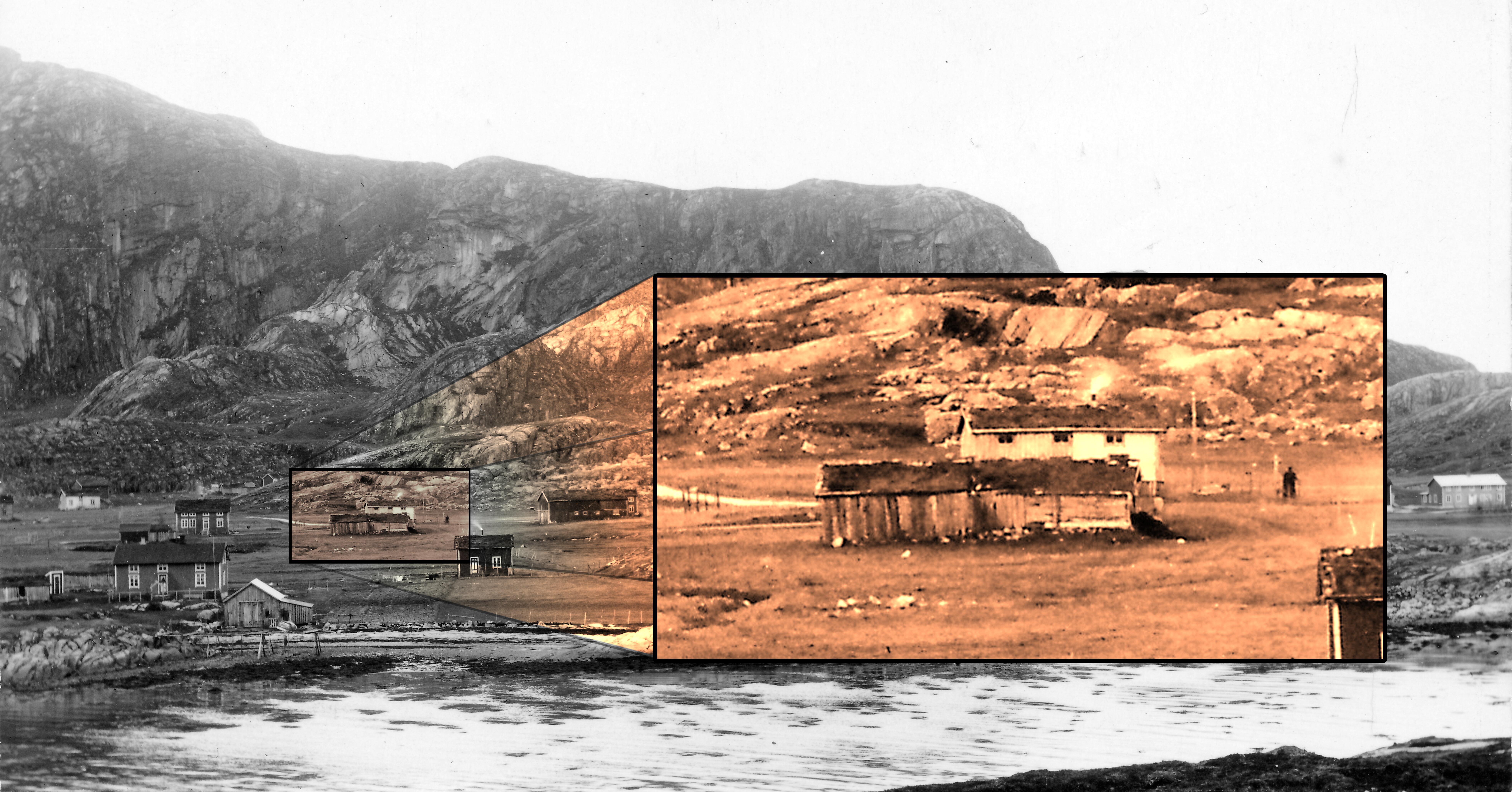
  • Last remaining house on Fellestunet 1938-40

    © H. Benonisen

  • Last remaining house on Fellestunet 1938-40

    © H. Benonisen

  • Last remaining house on Fellestunet 1938-40

    © H. Benonisen

Fellestunet

Right from the Middle Ages, most people on Bolga lived in a village-like fashion. Here they lived close together, next to each other in small houses, with fields and fields scattered around in a so-called “fellestun”.

The old fellestun was around the road junction between Øverveien and Nerveien, up towards Stuhågen. Further delineation is difficult, but the road possibly runs through the farmyard. When excavating in the area, there was, among other things, found fragment of a stamp with an inscription, “salvekrikke” made of burnt clay and a seam smoother made of glass mass.


Already from the 14th century, all land on Bolga was owned by the Catholic Church. After the Reformation in 1537, it was taken over by the king and later sold on to various landowners. Nevertheless, it should be mentioned that those who bought the land rarely farmed it. Those who lived here only rented the land and were thus so-called tenant farmers.

The tenants at Bolga farmed the land jointly. They did not have separate farms but used the different plots of land in turn. The other rights, such as egg collection and peat digging, were distributed according to how large a part the individual rented.
 

In 1868, the fields at Bolga were divided between the farms and gradually the houses were moved from “Fellestunet”.

Nevertheless, it should be mentioned that the community persisted. A farm board consisting of all the farmers was created. It was the board's task to ensure that all resources were still fairly distributed. 


This was a tradition that continued well into the 20th century. When there was to be a meeting, each farmer had his own chair or stool, as there was not enough to sit on for everyone.
From the middle of the 19th century, the tenants began to buy the farms, and became freeholders. The last farm was bought by the user in 1913.
Subject text: Per Swensen, Anne Marie Johnsen, Tone Lise Lyngeng

Screenplay: Helge Seim

Voices: Tone Lise Lyngeng

Editing: Helge Seim

Soundrecordings: LydBerger Sunflower Studios.


Music and Soundeffect: freesound.org


Source: 

  • Hutchinson A. (1997) Disse tider-Disse skikker
  • Moe K. (1981) Gård og grend i Meløy, bind 1
  • Utskiftning for Bolga 1867
  • Interveiw with old people before 1980.